
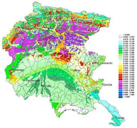
Seismic reclassification of the Region of Friuli Venezia Giulia
The proposed reclassification seismic territory of the region Friuli Venezia Giulia is aimed at identifying, training and updating of seismic zones of the region as required by the Ordinance 3274/03.
The seismic reclassification proposal has been developed jointly by the University of Udine, Trieste and OGS already achievers of

MAPP
Post-graduate specialization course in Business Management of prevention and
protection from professional risks.
A.y.: 2006-2007
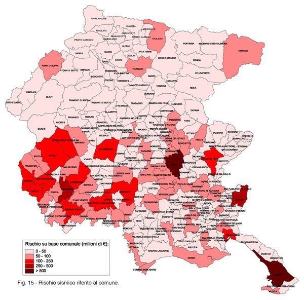
Seismic risk
The regional seismic risk map is a strategic tool in planning interventions on old buildings. In fact, it shows the value in thousands of euro for the seismic retrofitting refers to census tracts of Friuli Venezia Giulia.
The risk map has been prepared jointly by the University of Udine, Trieste
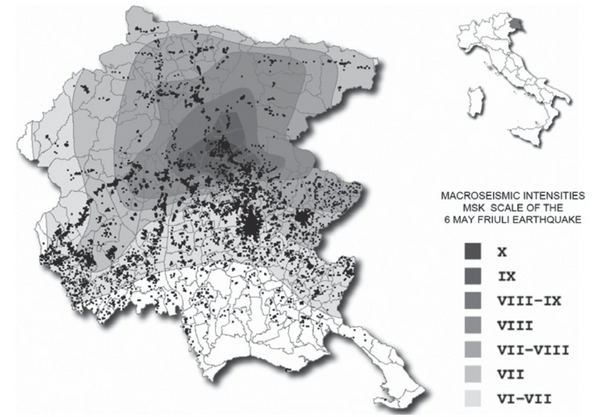
Fr.E.D. (Friuli Earthquake Damages)
After the May 6, 1976 earthquake in Friuli Venezia Giulia (North-East of Italy),
over one hundred villages were almost destroyed. More than 17000 houses, a large
number of schools, churches, town halls and factories were ruined. 45
municipalities were declared “destroyed”, 41 “damaged”, 52 “damaged”; the
homeless were about 150000.